The River View That Swallowed Rourke’s Last Lie
CHAPTER 2: FOUR FEET MISSING
Rourke called the disk decorative junk and ordered his manager to cover it. Dunn placed an evidence cone beside it and warned everyone away. Survey monuments did not migrate beneath expensive decks by accident.
Naomi remembered the code stamped under the federal seal: MB-17-4. Her father had used similar identifiers during thirty years in county flood control. Daniel Bell had died with his reputation damaged by rumors that he approved Rourke’s original permit. Naomi had joined the Guard partly to build work no rumor could bend.
Tessa set a survey rod on the monument and took three readings. The restaurant’s filed elevation certificate placed the brass disk four feet higher than the laser showed. Four feet was not a rounding error. It was the difference between ordinary waterfront property and regulated floodway.
“Who signed the certificate?” Dunn asked.
Tessa opened the county scan. “Preliminary review was mine. Final elevation was added after my submission.”
Her name still appeared on the last page.
Rourke spread his hands. “Then this is the county’s mistake. Put the bags back and compensate my guests.”
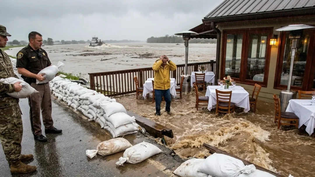
There were no guests. The evacuation alert had emptied the dining room, though place settings remained arranged for photographs Rourke planned to post online. Naomi watched water push against the intact public wall. Her crew tamped each bag so seams overlapped like brick. The flank held.
She directed soldiers to build a small ring around the exposed monument without changing water flow. If the disk vanished, its coordinates and photographs would survive. Dunn recorded every measurement on body camera while Tessa uploaded raw data to state servers.
The restaurant manager, June Park, approached under the awning. She said Rourke had ordered staff to set the deck after the flood warning because images of a full service would reassure investors. He also told maintenance workers to remove “ugly government markers” during last winter’s renovation. One worker refused and was fired.
“Name?” Dunn asked.
“Amos Reed. He lives upriver.”
Rourke shouted that June was dismissed. She removed her name badge and handed Dunn a ring of keys. “Then I no longer have a reason to protect your office.”
Inside, the upper dining room smelled of coffee, damp wool, and river mud. Dunn and Tessa entered only after Rourke consented to retrieve emergency maps. In a locked cabinet they found current evacuation plans, but the site drawing showed the deck ending at the legal setback. The actual structure extended thirty-eight feet beyond it.
Rourke revoked consent when he saw Dunn photographing the discrepancy. The deputy stopped the search and requested a warrant. Preserving procedure mattered because shortcuts would let money turn evidence into trespass.
Naomi remained outside. A levee is a system, not a wall. Closing one path forces water toward another. She walked the road shoulder with an engineer’s probe and found compacted gravel where permeable soil should be. Rourke had paved over the relief swale for valet parking, then disguised it with sod.
Earl Moseley, the towboat pilot, called on the emergency radio. His barges had cleared the bend, but he had seen water pouring from two pipes below the restaurant toward the Ward family farms. Those pipes did not appear on navigation maps.
Tessa pulled archived lidar onto her tablet. The land before construction formed a shallow public channel. The permit drawing preserved it. A later as-built plan replaced it with the restaurant foundation and showed a new berm along Rourke’s lot, certified at an elevation exactly four feet above reality.
The same four-foot error appeared everywhere: monument, deck, berm, and insurance map.
Tessa opened the raw survey package and compared units. The original field receiver stored elevations in meters; the amended certificate converted them to feet. A legitimate conversion would leave irregular decimals. The filed values ended in tidy quarters, evidence that someone had typed desired numbers instead of importing observations. Even the weather entry was wrong. It described a clear day, while archived radar showed six hours of rain.
Dunn called Amos Reed. The fired maintenance worker answered from a motel where he now repaired boat motors. He remembered finding the brass disk during renovation. Rourke told him to grind off its lettering and pour a column over it. Amos refused, photographed the marker beside that day’s newspaper, and lost his job before lunch. He still had the photograph and its original metadata.
Naomi asked him to send it directly to state investigators, not through her. The image arrived with coordinates intact. It showed Daniel Bell’s yellow survey rod beside the disk and an orange stake marking the legal setback. In the background, before the deck existed, the public swale curved openly toward the river.
Tessa measured the photograph against current dimensions. Rourke’s lower dining room did not merely cross an easement. Its foundation occupied the throat of the drainage channel, forcing stormwater under the deck and against the road embankment. The fraudulent elevation had converted an obvious prohibition into a buildable fiction.
Naomi asked who entered the number.
Tessa enlarged the document history. The revision came from the account of retired county assessor Miles Creel. Attached was a sensor-data file supporting the change.
The file’s creation date was two years after the sensor itself had been destroyed in an ice flood.
Tessa preserved the server headers and checksum before opening a copy. The false file would now remain provably unchanged from the version in the county archive.